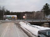
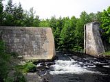
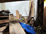
Last summer I shared a photo my father had sent me of a jury rigged stop sign in Petite Riviere. It was one of those "there, I fixed it" type photos.
Today, he posted another photo, this time to a Facebook account he uses to share historical photos from around Nova Scotia's south shore.
This particular photo holds no historical value.
It's worth mentioning, the stop sign that was zip-tied to it's post in July, is still held together by the same zip-ties.
26 November 2011
24 July 2011
Fixed it!
Every now and then my dad will send me a photo from home. Earlier this week, he emailed with several pictures of a shoddy repair made to a stop sign on Route 331 in Petite Riviere. The particular sign has had a hard life. Knocked over annually by snowplows, eventually the sign became loose from it's post. A crew was sent to repair the sign and this was the result.
I thought it appropriate to promptly share one of the photos at Thereifixedit.com and they featured it!
I thought it appropriate to promptly share one of the photos at Thereifixedit.com and they featured it!
Labels:
Dad,
Fail,
petite riviere
02 March 2011
HMCS Charlottetown
While at Fort Ogilvie, Point Pleasant Park this morning I caught the HMCS Charlottetown, a Halifax-class patrol frigate, leaving Halifax for sea trials prior to their departure later this evening. The ship will travel from Halifax to the coast of Libya in the Mediterranean Sea.
McNab's Island is in the background.

Link: HMCS Charlottetown (Canadian Navy)
McNab's Island is in the background.

Link: HMCS Charlottetown (Canadian Navy)
Labels:
hmcs charlottetown,
libya,
navy,
point pleasant park
01 February 2011
HMCS Cormorant
Former Canadian Forces diving support vessel docked at Bridgewater, NS. Purchased in 1975 and commissioned in 1978, the vessel remained in service until it was decommissioned in 1997. After some time in Shelburne, NS, the Cormorant was brought to Bridgewater in 2002.
View Larger Map
View Larger Map
Labels:
bridgewater,
HMCS Cormorant,
lunenburg county,
navy
26 January 2011
Georges Island & NS Power Lower Water Street Relocation
Just a quick update today with three photos from downtown Halifax.
This first is Georges Island. I've blogged about Georges several in the past and had the opportunity to visit the island drumlin in June 2008.
Some background on Georges Island...
The island was first fortified in 1750, shortly after Halifax was founded in 1749. During the Acadien Explusion from 1755 through 1763, those facing deportation were kept on the island, which doubled as a prison.
Defenses on the island were strengthened during the American Revolution, throughout the 1790s, and again during the War of 1812 and American Civil War. After 1850, with advances in technology, the fort was again overhauled, building the modern Fort Charlotte on the island.
Georges Island played a small role in Halifax's defense during both World Wars I and II, notably anchoring a submarine net protecting the inner harbour during World War 1 and housing an anti-aircraft unit throughout World War 2. Military service on the island ended with the war and it was declared a National Historic Site of Canada some twenty years later.
Unfortunately, Georges Island is not normally open to the public. Parks Canada continues to work to restore the island to allow public visitation in the future.
Source: Parks Canada - Georges Island National Historic Site of Canada

Nova Scotia Power's relocation to a former Lower Water Street generating station pushes on. The building's exterior appears mostly complete and the interior has some lighting. The power corporation plans to move into this location in the Spring of this year.
The utility boasts that the redeveloped building will reduce it's environmental footprint. The building's list of key features includes (among many others) LEED platinum certification, sea-water heating, rainwater irrigation, and the glass interior, or 'curtain-wall,' designed to maximize natural light.
Labels:
Georges Island,
halifax,
harbour,
ns power
17 January 2011
Public Service Commission Power Plant at Conquerall Mills

I've passed by the former Public Service Commission Power Plant in Conquerall Mills, Nova Scotia thousands of times in my life. For nearly twenty years, I drove by 'the power dam' daily. Over those twenty years, the only thing to change at the dam was the 'For Sale' sign. It has been privately owned for decades and was rumoured to be on and off the real estate market at various times throughout.
I visited and photographed the exterior of the power plant in January 2007 and again in June 2010. In that short span, only the boards covering the windows had changed. The area grows in considerably in the summer months.
Between visits to the power plant I was given a few historical photos of the dam. The photos were courtesy of my father who was scanning a collection of family photos. Among the scans were several newspaper clippings and two very grey photographs. The photographs show the power plant on the day it became operational some time around 1940.
1. Public Service Commission Power Plant on the day it became operational.
2. A second photo from the same day. To the left is my great-grandfather's 1939 Packard.

11 January 2011
Downtown Halifax Tunnels

Photo: National Resources Canada
For decades construction crews have been bumping into passageways beneath Halifax's downtown core. The tunnels under Halifax have been written about and discussed for decades. The official line was that they were not actually passageways, but sewers.They're definitely not sewers.
Photographs taken in 1976 show rock walls with arched ceilings, approximately six feet high, and wooden floors.
Rumours suggest that many of the older buildings that did, and still do, stand downtown could access these tunnels from their basement level.
We know there are, or were prior to development, stone passageways under many streets in the core. What we can't seem to agree on, or confirm true, is the existence of other tunnels branching out from the downtown. Some believe a tunnel connects Brunswick Street to the Halifax Citadel. Others suggest a tunnel connects the Halifax Citadel to the Halifax Armoury at the corner of North Park and Cunard Street. Both make sense, but I have yet to encounter anyone who can confirm or deny they're actually there.
Then there is the tunnel that allegedly runs from somewhere near the harbour, presumably near Sackville at Lower Water Street, and then beneath the harbour floor, eventually surfacing on the once militarized George's Island.
The George's Island under-water passage has been debunked but some of the mystery still remains in the words of 19th century mason John William Cameron. Cameron, although sworn to secrecy, claimed to have built two tunnels under Halifax- the tunnel to the Citadel as well as the tunnel to the island.
Over time I've built a map to illustrate where the tunnels might potentially lie. To my knowledge, only a few of them are at all accessible.
View Downtown Halifax Tunnel System in a larger map.
Confirmed (Blue Marker) ― These are documented tunnel entrances, some verified by photo. | Date | Entrance Location |
| 2012 | 1682 Hollis St (Halifax Club) |
| 1995 | Sackville St at Lower Water St |
| 1977 | Duke St at Granville St |
| 1976 | Price St at Grafton St |
| 1973 | George St |
| 1938 | Duke St at Market St |
| 1919 | Town Clock |
Rumoured (Yellow Marker) ― These tunnel entrances range from speculative to debunked.
| Date | Entrance Location |
| 1995 | Prince St at Market St |
| - | 1740 Granviille St (Dennis Building) |
Blue Lines ― Represent tunnels that almost certainly do, or did, exist.
Red Lines ― Represent tunnels that do not exist, or are not likely to exist.
Labels:
citadel,
Georges Island,
halifax,
Halifax Armoury,
John William Cameron,
tunnels
08 January 2011
Rehabilitation Centre Video
Filmed in October 2009.
Follow the camera through the halls and wards of a former county rehabilitation centre abandoned in 2002.
Labels:
urbex
Subscribe to:
Comments (Atom)
halifax
harbour
WW2
york redoubt
Georges Island
mcnabs island
navy
ww1
York Shore Battery
Strawberry Battery
bridgewater
tunnels
MARMU2014
NATO
chronicle herald building
citadel
demolition
lunenburg county
petite riviere
searchlights
Conquerall Mills
Dad
Fort McNab
Roy Building
Shaw Building
Waterside Centre
green bay
hcrrc
historic properties
ifr
ns power
point pleasant park
power plant
satellite
toronto
320i
Anti-Aircraft
CSS Acadia
Fail
Ferguson's Cove
Fishwick Building
Halifax Underground
Harrington MacDonald-Briggs Building
Imperial Oil Building
Partridge Island
Risser's Beach
Saint John
Silva
Theodore Too
coast guard
fort chebucto
fort ives
hydroelectric
spion kop
teleglobe
urbex
APA
BOH2013
Bill Lynch
Crescent beach
Dartmouth
Duncan's Cove
Elizabeth II
Fort Charlotte
HMCS Cormorant
HMCS Sackville
HMCS Vancouver
Halifax Armoury
John William Cameron
Mar
Pier 21
Rara-Avis
Roald Amundsen
Shannon Park
South Shore Mall
blog
cambridge battery
christmas
city centre atlantic
coffee
connaught battery
crousetown
gulf oil spill
hearn
hmcs charlottetown
hms liverpool
hms sutherland
iihf
into the darkness
libya
links
lower sackville
maps
motorcade
ms maasdam
natal day
police
queen
seaport farmers market
tattoo
the coast
timberlea
tugboats
urban explorers
whc


