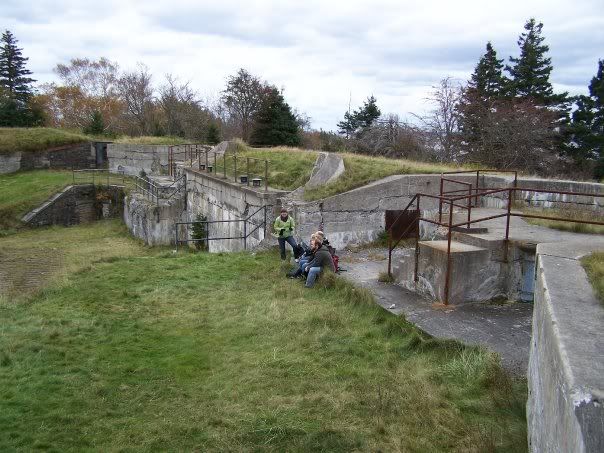
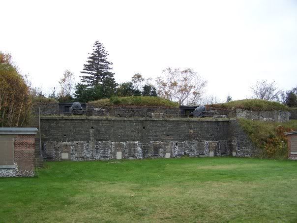
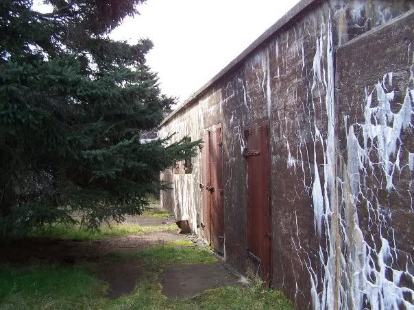
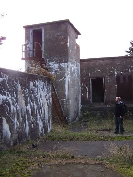
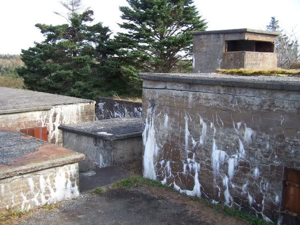
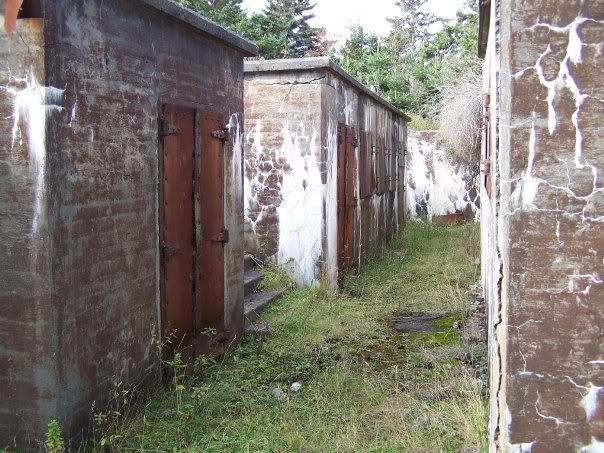
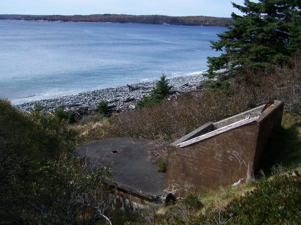
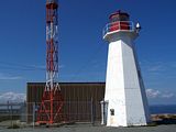
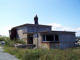
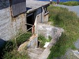
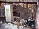
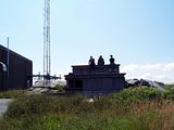
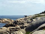
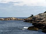
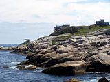
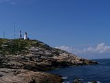
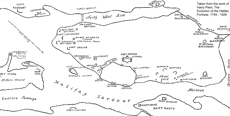
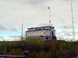
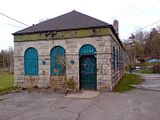
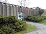
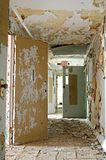
Photos from an October 2008 trip to Fort Ives, found on McNab's Island in Halifax Harbour.
1. Fort Ives
2. Resting at Fort Ives.
3. Guns remain mounted at Fort Ives.
4. Wall of Fort Ives slowly erode.
5. Inside the powerhouse on Garrison Road.
6. Again, inside the powerhouse.
7. Vintage fridge found in the childhood home of Bill Lynch.
View McNabs Island in a larger map
22 October 2008
21 October 2008
Strawberry Battery
Photos from an October 2008 trip to Strawberry Battery, found on McNab's Island in Halifax Harbour.
1. Entering Strawberry Battery.
2. Watch your step.
3.
4. Most everything here was sealed. What wasn't sealed, wasn't all that exciting.
5. One of the light emplacements below Strawberry Battery.
View McNabs Island in a larger map
1. Entering Strawberry Battery.
2. Watch your step.
3.
4. Most everything here was sealed. What wasn't sealed, wasn't all that exciting.
5. One of the light emplacements below Strawberry Battery.
View McNabs Island in a larger map
Labels:
halifax,
harbour,
mcnabs island,
Strawberry Battery,
WW2
20 October 2008
Fort McNab
Photos from an October 2008 trip to Fort McNab, found on McNab's Island in Halifax Harbour.
1. Crumbling exterior of Fort McNab Casemates building.
2. Entering Fort McNab's subterranean through the Left Magazine entrance.
3. Fort McNab's Radar Building and Left Magazine entrance.
4. Inside the Crew Shelter building at Fort McNab.
5. Scary dark furnace at Fort McNab.
6. McNab Cemetery
View McNabs Island in a larger map
Labels:
Fort McNab,
halifax,
harbour,
mcnabs island,
ww1,
WW2
28 September 2008
School Day!
Faced with an approaching hurricane, we had to cram as many abandonments into our weekend as possible before the rain and wind picked up.
Chris, again visiting Atlantic Canada, encouraged us all to get out and take him on another tour of Nova Scotia's forgotten buildings. We didn't expect a race against a massive storm to accomplish this task.
Saturday the 27th was spent relatively close to my home in Halifax. It was suggested by Adam and Steve that we explore several schools in the HRM which had closed up over the years and fell into ruin.
Our first stop was... Rotten Ronnie's... SoRandy Chris could slam a couple cheeseburgers back for breakfast.
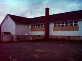
From there, we drove from the Halifax peninsula toward the South Shore, arriving several minutes later at a school in Timberlea which had obviously been abandoned for years. All of the windows had been broken over time and covered by wood. We walked the perimeter before finding an access point on the lower level of the building were a vandal had removed the boards from a window.
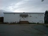
We walked throughout the school discovering it's many levels of disrepair. While some classrooms remained in relatively good shape, the ceiling of others had began to fail, allowing water to pour in over time. Seaweed insulation could be found hanging from holes in the ceiling where the plaster and tiles had gave way. Debris on the floor below the ceiling holes had turned to a slippery mush.
We finished our walk and made our way out of the building through the open window we had slipped in through. We replaced the boards on the outside of the window in an effort to prevent future entry by vandals, taggers and scrappers.
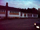
From Timberlea, we drove to Lower Sackville in search of another abandoned school. This building served many functions over the years based on the knowledge of Adam and Steve and the evidence found within. The building had obviously been a school at one point, as well as a community centre and food bank depot.
We parked to the rear of the building and quickly found an access point created in the same manner as the last school. It was immediately appearant that this building was far less pristene than that of the last. Examples of graffiti, some of the worst I've personally witnessed, and vandalism were everywhere. Heavy furniture and kitchen appliances had been toppled or tossed about. We must have found hundreds of cans of discarded spray paint, some still full.
The majority of the windows had been broken, many of them from within the building by what we assume are local vandals.
From Lower Sackville we drove back to Halifax and back to our home base... The McDonalds on Kempt Road. The team ate a few more cheeseburgers before heading to York Redoubt where we were able tour the Base Command Post (BCP) building normally closed to the public. Complete with electricity, we toured the BCP and it's underground bunker for nearly thirty minutes.
Chris, again visiting Atlantic Canada, encouraged us all to get out and take him on another tour of Nova Scotia's forgotten buildings. We didn't expect a race against a massive storm to accomplish this task.
Saturday the 27th was spent relatively close to my home in Halifax. It was suggested by Adam and Steve that we explore several schools in the HRM which had closed up over the years and fell into ruin.
Our first stop was... Rotten Ronnie's... So
From there, we drove from the Halifax peninsula toward the South Shore, arriving several minutes later at a school in Timberlea which had obviously been abandoned for years. All of the windows had been broken over time and covered by wood. We walked the perimeter before finding an access point on the lower level of the building were a vandal had removed the boards from a window.
We walked throughout the school discovering it's many levels of disrepair. While some classrooms remained in relatively good shape, the ceiling of others had began to fail, allowing water to pour in over time. Seaweed insulation could be found hanging from holes in the ceiling where the plaster and tiles had gave way. Debris on the floor below the ceiling holes had turned to a slippery mush.
We finished our walk and made our way out of the building through the open window we had slipped in through. We replaced the boards on the outside of the window in an effort to prevent future entry by vandals, taggers and scrappers.
From Timberlea, we drove to Lower Sackville in search of another abandoned school. This building served many functions over the years based on the knowledge of Adam and Steve and the evidence found within. The building had obviously been a school at one point, as well as a community centre and food bank depot.
We parked to the rear of the building and quickly found an access point created in the same manner as the last school. It was immediately appearant that this building was far less pristene than that of the last. Examples of graffiti, some of the worst I've personally witnessed, and vandalism were everywhere. Heavy furniture and kitchen appliances had been toppled or tossed about. We must have found hundreds of cans of discarded spray paint, some still full.
The majority of the windows had been broken, many of them from within the building by what we assume are local vandals.
From Lower Sackville we drove back to Halifax and back to our home base... The McDonalds on Kempt Road. The team ate a few more cheeseburgers before heading to York Redoubt where we were able tour the Base Command Post (BCP) building normally closed to the public. Complete with electricity, we toured the BCP and it's underground bunker for nearly thirty minutes.
Labels:
halifax,
lower sackville,
timberlea,
york redoubt
10 August 2008
Chebucto Head & Fort Chebucto
I was finally able to make it out to the ruins and reclaimed portions of Fort Chebucto found in Duncan's Cove outside of Halifax, NS. Fort Chebucto was operational during the Second World War from 1943 until 1945.
View Halifax Defence Complex in a larger map
1. Ruins of Fort Chebucto's light emplacements in the distance.
2. Active RDF Station at Chebucto Head.
3. Tristan checking out the roof of the Depression Range Finder building at Chebucto Head.
4. Entering the Depression Range Finder building.
5. Inside the Depression Range Finder building.
6. Group shot atop the Depression Range Finder building at Chebucto Head.
7. Light emplacement ruin below the reclaimed Base Command Post (BCP) of Fort Chebucto.
8. Light emplacement ruin below the reclaimed Base Command Post (BCP) of Fort Chebucto.
9. Rocky cliff below Fort Chebucto.
10. Light emplacement ruin below the reclaimed Base Command Post (BCP) of Fort Chebucto.
11. Looking back at the RDF Station from nearby to the light emplacement ruin.
Labels:
Duncan's Cove,
fort chebucto,
halifax,
searchlights,
WW2
26 July 2008
Odds & Ends
I haven't posted anything in a while so I thought I'd share some of the local odds and ends photos and scans I've collected along the way.
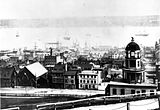
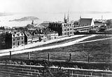
1. Downtown Halifax, 1880s. Photo c/o Canadian Navy.
2. Downtown Halifax, 1880s. Photo c/o Canadian Navy.
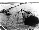
3. Halifax Harbour, May 1942. Photo c/o Canadian Navy.
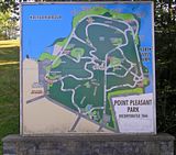
4. Map of Point Pleasant Park at it's entrance.
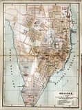
5. Undated historic map of Halifax.
6. Undated historic map of Halifax.
1. Downtown Halifax, 1880s. Photo c/o Canadian Navy.
2. Downtown Halifax, 1880s. Photo c/o Canadian Navy.
3. Halifax Harbour, May 1942. Photo c/o Canadian Navy.
4. Map of Point Pleasant Park at it's entrance.
5. Undated historic map of Halifax.
6. Undated historic map of Halifax.
16 June 2008
Exploring Georges Island
Somehow we managed to arrive in time to make our 10am ferry to Georges Island. We met our friends in the terminal and boarded a somewhat overcrowded Metro Transit ferry.
The island was great. Very well preserved considering some of the harsh weather it sees. Photo opportunities were sadly scarce though due to its temporary over-population. The island did provide some unique views of the city and I was able to take some, if nothing else, interesting shots inside, above and beneath Fort Charlotte.
Below are a handful of the pictures I was able to take during our 1h 45m trip to Georges Island
View Halifax Defence Complex in a larger map
The island was great. Very well preserved considering some of the harsh weather it sees. Photo opportunities were sadly scarce though due to its temporary over-population. The island did provide some unique views of the city and I was able to take some, if nothing else, interesting shots inside, above and beneath Fort Charlotte.
Below are a handful of the pictures I was able to take during our 1h 45m trip to Georges Island
View Halifax Defence Complex in a larger map
Labels:
citadel,
Fort Charlotte,
Georges Island,
halifax,
Pier 21,
ww1,
WW2
27 May 2008
Explore Georges Island
I was excited to learn that Parks Canada and the Offshore/Onshore Technologies Association of Nova Scotia (OTANS) will be allowing the general public to experience Georges Island National Historic Site.
Kate and I bought our tickets for Sunday, June 15's 10am ferry.
View Halifax Defence Complex in a larger map
Saturday, June 14, 2008
10am, 11am, 12pm, 1pm or 2pm start times
Sunday, June 15, 2008
10am, 11am, 12pm, 1pm or 2pm start times
Arrive at the terminal 15 minutes prior to departure.
The last ferry leaves from Georges Island promptly at 3:45 pm.
Located in the heart of Halifax Harbour, this National Historic Site derives its historical significance from its former role in the Halifax Defence System. Georges Island is not currently open to the public, but in response to public interest, Parks Canada and OTANS have worked together to create this event.
“Explore Georges Island” will provide visitors with a rare chance to explore the island, learn about its rich military past and enjoy the spectacular harbour views! -- OTNAS (Link)
Kate and I bought our tickets for Sunday, June 15's 10am ferry.
View Halifax Defence Complex in a larger map
Saturday, June 14, 2008
10am, 11am, 12pm, 1pm or 2pm start times
Sunday, June 15, 2008
10am, 11am, 12pm, 1pm or 2pm start times
Arrive at the terminal 15 minutes prior to departure.
The last ferry leaves from Georges Island promptly at 3:45 pm.
Labels:
Georges Island,
halifax
27 May 08
After work today I dropped by a local abandonment with a friend to survey the extent of the damage. It was bad... Far worse than it was several weeks ago. I'd call it an 'open-air' location now as there is not a window left in the building that hasn't been smashed. Vandals have taken to removing the boards from the window just to break the glass and walls and floors suddenly have holes in them.
I've included several pictures.
1. Exterior
2. Interior. That is a rock.
3. Interior. That is a log.
I've included several pictures.
1. Exterior
2. Interior. That is a rock.
3. Interior. That is a log.
Labels:
halifax
22 May 2008
22 May 08
My friend and I took a wrong turn at the Armdale Roundabout and wound up turning around on a street we'd never been on before. We followed this street until the pavement became dirt and found this facility and what I assume to be it's modern replacement at the dead end.
It is assumed that this building and the modern facility behind it have to do with the purification of Halifax's water supply. The modern building is active and machinery can be heard through it's walls.
Labels:
halifax
18 May 2008
Added Links
I've added two links to the list on the right sidebar.
Panoramio (from Google) allows you to upload and map your own photos to be displayed on Google Maps and Google Earth.
The System is is a Scottish website featuring photography by TurboZutek and friends, of abandoned places throughout Scotland and abroad. It gives photography amateurs a place to share their knowledge and experiences about Urban Exploration.
16 May 2008
Rehabilitation Centre - Photo
Chris (aka TurboZutek) granted my request to display some of the photos he'd taken while at the rehabilitation centre.
Photo c/o Chris @ The SYSTEM: Urban Exploration in Scotland
Labels:
hcrrc
15 May 2008
IIHF World Hockey Championship
My girlfriend Kate and I had the opportunity to check out the final game of the IIHF World Hockey Championship in Halifax. It was the quarterfinal game between the United States and Finland. The game was fast paced and the skill level of many of the players was amazing.
Both Teemu Selanne and Olli Jokinen finished the game with two points as Finland defeated the United States 3 - 2 in overtime to move on to the semifinal game. Finnish goals scored by Tuomo Ruutu (Carolina Hurricanes), Janne Niskala (Nashville Predators) and overtime winner Sami Lepisto (Washington Capitals). American goals scored by Phil Kessel (Boston Bruins) and Drew Stafford (Buffalo Sabres).
1. Tied at 2 - 2 with under 4 minutes remaining in the 3rd Period.
2. Face-off in the United States end during overtime.
3. Final score 3 - 2 in favour of Finland. Flag is raised, Finnish national anthem is played.
4. Kate and I following the game wearing Skoda Auto helmets. She looks good, I don't.
Both Teemu Selanne and Olli Jokinen finished the game with two points as Finland defeated the United States 3 - 2 in overtime to move on to the semifinal game. Finnish goals scored by Tuomo Ruutu (Carolina Hurricanes), Janne Niskala (Nashville Predators) and overtime winner Sami Lepisto (Washington Capitals). American goals scored by Phil Kessel (Boston Bruins) and Drew Stafford (Buffalo Sabres).
- Team Line-ups (pdf)
- Game Summary (pdf)
1. Tied at 2 - 2 with under 4 minutes remaining in the 3rd Period.
2. Face-off in the United States end during overtime.
3. Final score 3 - 2 in favour of Finland. Flag is raised, Finnish national anthem is played.
4. Kate and I following the game wearing Skoda Auto helmets. She looks good, I don't.
Subscribe to:
Posts (Atom)
halifax
harbour
WW2
york redoubt
Georges Island
mcnabs island
navy
ww1
York Shore Battery
Strawberry Battery
bridgewater
tunnels
MARMU2014
NATO
chronicle herald building
citadel
demolition
lunenburg county
petite riviere
searchlights
Conquerall Mills
Dad
Fort McNab
Roy Building
Shaw Building
Waterside Centre
green bay
hcrrc
historic properties
ifr
ns power
point pleasant park
power plant
satellite
toronto
320i
Anti-Aircraft
CSS Acadia
Fail
Ferguson's Cove
Fishwick Building
Halifax Underground
Harrington MacDonald-Briggs Building
Imperial Oil Building
Partridge Island
Risser's Beach
Saint John
Silva
Theodore Too
coast guard
fort chebucto
fort ives
hydroelectric
spion kop
teleglobe
urbex
APA
BOH2013
Bill Lynch
Crescent beach
Dartmouth
Duncan's Cove
Elizabeth II
Fort Charlotte
HMCS Cormorant
HMCS Sackville
HMCS Vancouver
Halifax Armoury
John William Cameron
Mar
Pier 21
Rara-Avis
Roald Amundsen
Shannon Park
South Shore Mall
blog
cambridge battery
christmas
city centre atlantic
coffee
connaught battery
crousetown
gulf oil spill
hearn
hmcs charlottetown
hms liverpool
hms sutherland
iihf
into the darkness
libya
links
lower sackville
maps
motorcade
ms maasdam
natal day
police
queen
seaport farmers market
tattoo
the coast
timberlea
tugboats
urban explorers
whc