
Just wanted to share a really short video clip (c/o Jacob) from our trip to Partridge Island last month.
Showing posts with label WW2. Show all posts
Showing posts with label WW2. Show all posts
06 June 2012
03 May 2012
Partridge Island
Early in the morning on April 30, Jacob and I left Halifax heading for Saint John, New Brunswick. It was pouring rain in Halifax, but forecasts suggested the weather be better at our destination so we decided to go for it. About thirty minutes outside of Saint John, the rain subsided. The fog, on the other hand, stuck around.
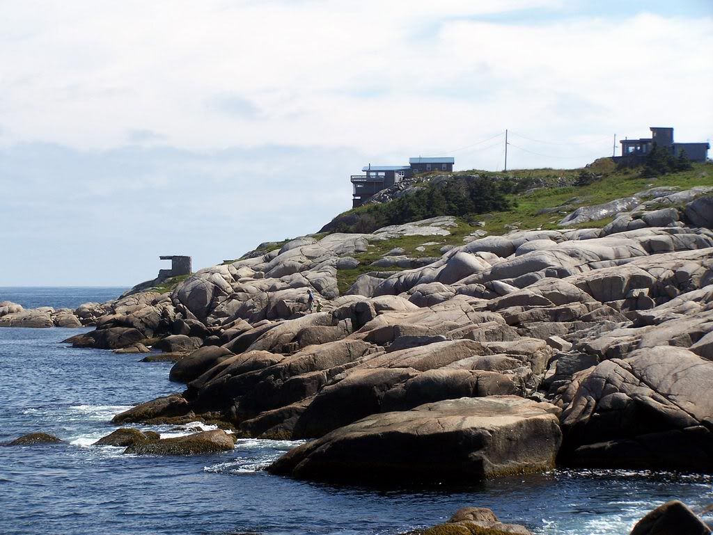
We went to Saint John to see Partridge Island, a National Historic Site of Canada. The island served as a quarantine station from 1785 until 1941. Immigrants and crew members were processed on the island, and the ill were treated at the island's first hospital, built in 1830. Irish immigrants fleeing the potato famine in 1847 were quarantined on Partridge Island. Of two thousand deaths in 1847, six hundred are buried in mass graves on the island.
While Partridge Island was one of the busiest quarantine stations in Canada throughout the nineteenth century, it was also Saint John's primary military fortification until the years following World War Two. Initially fortified around the time of the War of 1812, the island's defences were expanded to thwart Fenian raids throughout the mid-1800s, and even further during the First and Second World Wars.
To get to the island, we knew we'd need to navigate the nearly one kilometre long breakwater extending from Saint John harbour. Initially there was concern about the tide. We knew that it would be about mid tide upon arrival, and would be at it's highest on the return trip across. The day before we left Jacob found a photo online showing that breakwater at high tide and it appeared the tide, even at it's highest, would not be a problem. You certainly wouldn't catch me out there in high winds or high seas, however. We quickly found the most dangerous part of the breakwater to be the fall hazard. Falling between rocks was a real possibility.

Crossing the breakwater was a tough task. When we finally did land on the island we were met with a short vertical climb up a very slippery rock face. There is, and has been a rope tied above to help climbers. We certainly needed it. There is something scary about trusting an undated rope tied to an unknown object by an unknown person.

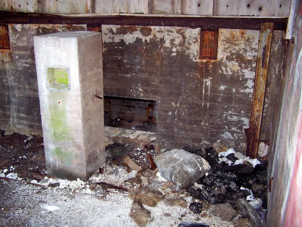
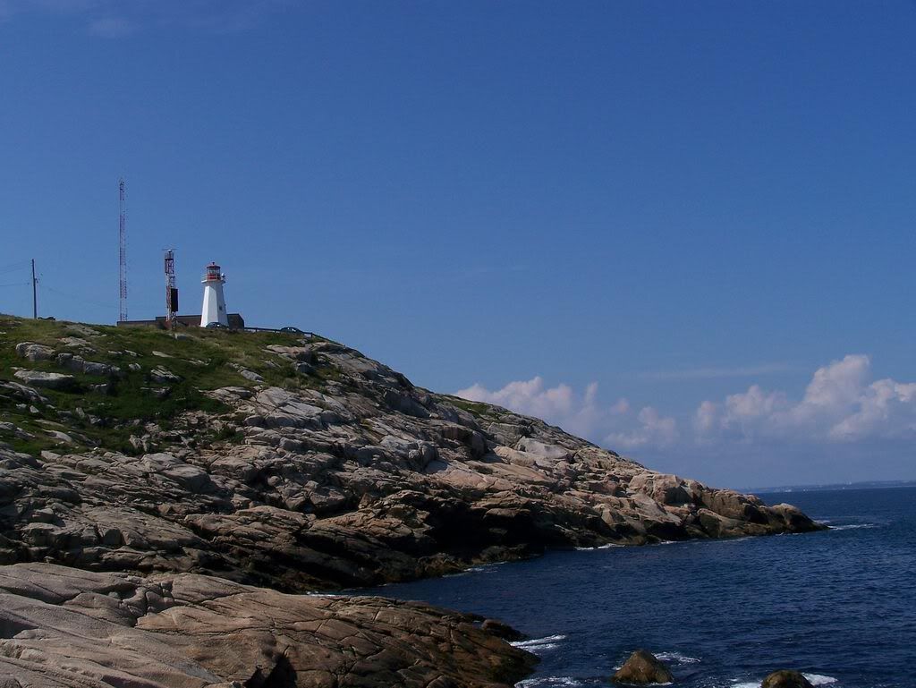
We had the luxury of a map to guide us around the island. We followed the beaten paths, and used the map's key to identify what crossed our path. The first thing you see after you climb up from the breakwater is the island's automated lighthouse. Not far from the lighthouse is the first military building we encountered, one of the two Radar Battery Observation Posts on the island. The third floor provided for a good view of what else the island had to offer. We did not remain inside this building very long. The smell became worse as we made our way to the top floor. Once there, it was obvious that the burning of insulation was to blame for the foul odour. This was the first of many examples of arson apparent around the island.


The path from the Radar Battery Observation Post lead us through some light brush to a series of gun shelters and their underground magazines. It appears as if access to the underground was, at some time, prevented. Any barriers are now gone and accessing the magazines was easy. It was very dark inside, a good flashlight was absolutely necessary. Many hazards were present on the stairs and floor.


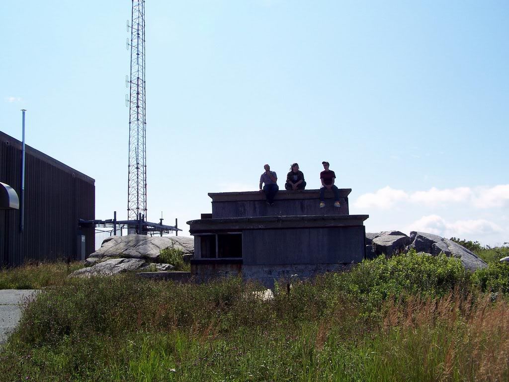
Above the gun shelters was the second Radar Battery Observation Post and a twelve metre Celtic Cross beside it. The cross was erected in 1927 in memory of Irish immigrants who died during 1847 quarantine mentioned earlier.
 This Battery Observation Post, during wartime, was decorated with the facade of a summer cottage. The facade is gone, it sits today as an empty concrete shell. Accessing the upper observation floor was difficult but not impossible. I chose to pass as the fog had turned into a very heavy mist by this point.

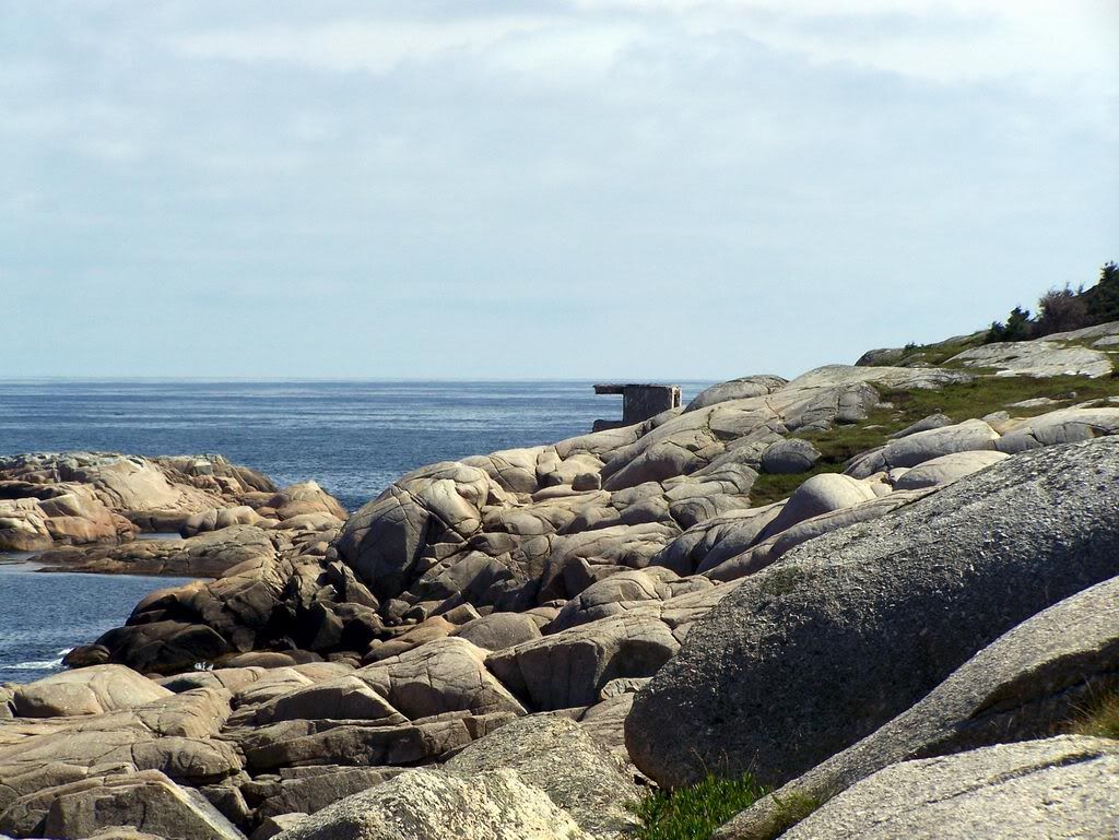
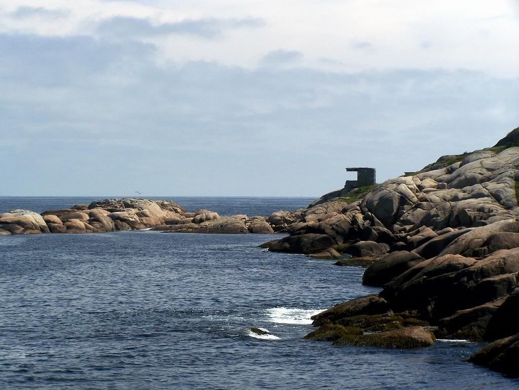
 We circled back below the gun shelters finding the path that would take us north across the island, passing several cemeteries of various faiths, several gun mounts, searchlight emplacements, the Coast Artillery Searchlight Power Plant, and the foundations of several hospitals, quarters and other buildings. The path landed us at the island's collapsed wharf. The remains of an old power plant were visible but by now the mist had turned to rain and we made the decision to head back to the breakwater. The walk back to the cliff took us by more foundations, notably the first and second class hospitals.


Getting down the cliff was tricky in driving rain but there were no falls. 'Brutal' sums up the return trip across the breakwater. Rain and wind blowing spray from the ocean kept us moving, even though we were totally exhausted. Moving from rock to rock became difficult. It likely took us twice as long to navigate the breakwater on our return trip, maybe more. Climbing the hill once on shore was no prize.
We headed back the paths to the van and changed into what was dry, and turned the heat on. At the time, I said I wouldn't go back. I would like to go back as the trip was a little hurried by deteriorating weather. I'm going to need to work on my endurance in the mean time.
Sources:
HistoricPlaces.ca: Partridge Island Quarantine Station National Historic Site of Canada
NBCC Heritage Resources: Partridge Island
LegionMagazine.com: The Sad Story Of Partridge Island by Linda Hersey (2007)
We went to Saint John to see Partridge Island, a National Historic Site of Canada. The island served as a quarantine station from 1785 until 1941. Immigrants and crew members were processed on the island, and the ill were treated at the island's first hospital, built in 1830. Irish immigrants fleeing the potato famine in 1847 were quarantined on Partridge Island. Of two thousand deaths in 1847, six hundred are buried in mass graves on the island.
While Partridge Island was one of the busiest quarantine stations in Canada throughout the nineteenth century, it was also Saint John's primary military fortification until the years following World War Two. Initially fortified around the time of the War of 1812, the island's defences were expanded to thwart Fenian raids throughout the mid-1800s, and even further during the First and Second World Wars.
To get to the island, we knew we'd need to navigate the nearly one kilometre long breakwater extending from Saint John harbour. Initially there was concern about the tide. We knew that it would be about mid tide upon arrival, and would be at it's highest on the return trip across. The day before we left Jacob found a photo online showing that breakwater at high tide and it appeared the tide, even at it's highest, would not be a problem. You certainly wouldn't catch me out there in high winds or high seas, however. We quickly found the most dangerous part of the breakwater to be the fall hazard. Falling between rocks was a real possibility.
Crossing the breakwater was a tough task. When we finally did land on the island we were met with a short vertical climb up a very slippery rock face. There is, and has been a rope tied above to help climbers. We certainly needed it. There is something scary about trusting an undated rope tied to an unknown object by an unknown person.

We had the luxury of a map to guide us around the island. We followed the beaten paths, and used the map's key to identify what crossed our path. The first thing you see after you climb up from the breakwater is the island's automated lighthouse. Not far from the lighthouse is the first military building we encountered, one of the two Radar Battery Observation Posts on the island. The third floor provided for a good view of what else the island had to offer. We did not remain inside this building very long. The smell became worse as we made our way to the top floor. Once there, it was obvious that the burning of insulation was to blame for the foul odour. This was the first of many examples of arson apparent around the island.
The path from the Radar Battery Observation Post lead us through some light brush to a series of gun shelters and their underground magazines. It appears as if access to the underground was, at some time, prevented. Any barriers are now gone and accessing the magazines was easy. It was very dark inside, a good flashlight was absolutely necessary. Many hazards were present on the stairs and floor.

Above the gun shelters was the second Radar Battery Observation Post and a twelve metre Celtic Cross beside it. The cross was erected in 1927 in memory of Irish immigrants who died during 1847 quarantine mentioned earlier.


Getting down the cliff was tricky in driving rain but there were no falls. 'Brutal' sums up the return trip across the breakwater. Rain and wind blowing spray from the ocean kept us moving, even though we were totally exhausted. Moving from rock to rock became difficult. It likely took us twice as long to navigate the breakwater on our return trip, maybe more. Climbing the hill once on shore was no prize.
We headed back the paths to the van and changed into what was dry, and turned the heat on. At the time, I said I wouldn't go back. I would like to go back as the trip was a little hurried by deteriorating weather. I'm going to need to work on my endurance in the mean time.
Sources:
HistoricPlaces.ca: Partridge Island Quarantine Station National Historic Site of Canada
NBCC Heritage Resources: Partridge Island
LegionMagazine.com: The Sad Story Of Partridge Island by Linda Hersey (2007)
11 December 2010
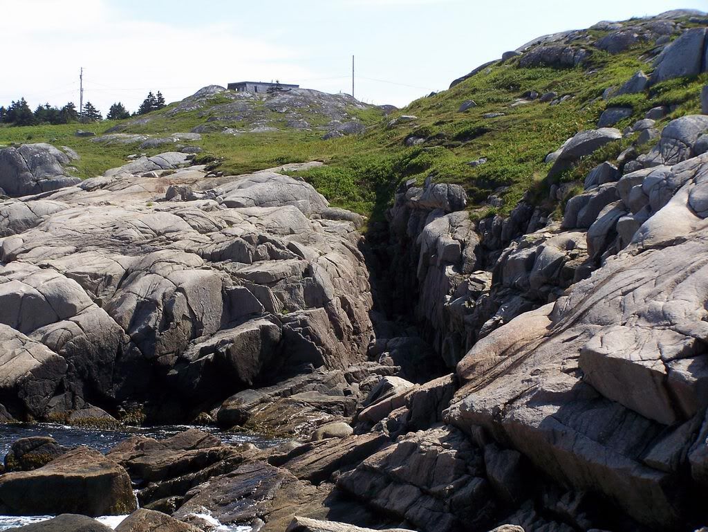
Shoreline Erosion at York Shore Battery
While out walking earlier a few weeks ago we walked around the perimeter fence at York Shore Battery, below York Redoubt, to check things out. I hadn't been to the World War II era anti-submarine station in several months.
Not surprisingly, very little has changed at York Shore Battery since my previous visit. We did, however, notice that the erosion of the shoreline below the battery is rapidly deteriorating. Much of the reinforcements have failed.
The missing soil makes accessing the three adjacent light emplacements difficult and we didn't attempt it. You'll need to travel through the brush over unstable earth to make the trip.
York Shore Battery itself is not yet in danger of falling into the harbour. That shouldn't happen. However, the foundation of at least one of the light emplacements is being washed out on a regular basis. There will come a day when it, or they, will topple, depending on how well they're anchored to the hillside.

View York Redoubt in a larger map
11 October 2010
Stabilizing Fort McNab
As part of the federal government's economic action plan $1 025 000 (actionplan.gc.ca) was earmarked for the "stabilization of selected historic assets within the Fort McNab." Fort McNab was and is falling to pieces and many parts of the cannot be considered safe for unguided public access. The result of the stabilization should provide safe unguided public access to the fort. The work began during in September 2010. I became aware when Friends of McNabs announced via Twitter (Friends of McNabs @Twitter) that the fort would be upgraded, getting a "$1.6 million facelift," and would be closed to the public for the remainder of the year.
It was my assumption that major aspects of the fort's stabilization would include repairs to the crumbling building facades and the limiting of access to areas determined to be unsafe. Most of the access to underground areas was sealed years ago, I assume the remaining tunnels will be closed off as part of efforts to stabilize the fort.
When I visited Fort McNab with a group of close friends late in September 2010 work was already underway. My assumption that work would be done on crumbling building exteriors was confirmed by scaffolding. We were all pleasantly surprised to see much of the brush and overgrowth cut back revealing all kinds of new views.
We had a great time on the island again this year. Every time we visit we find something new or previously overlooked. I still haven't figured out an effective way to carry all of my gear and I have yet to learn how much water is enough. Apparently I need more than three litres for a twenty-four hour stay. We spent the night in tents after hiking through the interior, to McNabs Pond Trail to Strawberry Battery and back out through the Cliff Trail.
Taylor Made Tours (Capt. Steve Taylor, 902-448-4982/902-465-6272, Fisherman's Cove, Eastern Passage) ferried us to and from the island.
See also:
19 June 2010
Update: Purcell's Cove Foundation
It turns out that the foundation in Purcell's Cove I wrote about on May 28 was a military installation as suspected.
Built in 1942 this foundation was once the 18th Anti-Aircraft Battery.
1.

2.

Built in 1942 this foundation was once the 18th Anti-Aircraft Battery.
1.

2.

28 May 2010
Purcell's Cove Foundation
Near Purcell's Cove Road lies an odd foundation in the middle of the forest.
I know next to nothing about it.
My best guess is that it was built and utilized by our military but has been unoccupied, perhaps even totally abandoned since World War II, at the absolute latest. The area is entirely grown in however it is easy to tell where roads and clearings once existed. It has been growing unchecked for a very long time, at least sixty-five or more years in my opinion.
Unfortunately, I can't share this location's coordinates as its condition is pristine and I'd hate to see it vandalized because of something I wrote here.
1. On Approach.
2. Inside.
3. Nearby.

If you happen to know a thing or two about this structure and would like to share, I encourage you to contact me through this website or any of my links on the right.
02 August 2009
McNabs Island - Natal Day 2009
Jacob, Chris and I arrived on the island at 11:30am on August 1 and walked from Back Cove to Fort McNab, via Garrison Rd, and then to Strawberry Battery, via McNabs Pond Trail for the night. Most of the McNabs Pond Trail is overgrown. We were told DNR is allowing the overgrowth to happen to deter travel to Strawberry Battery. We cleaned up a big piece of the former battery and set up camp on the concrete. The following morning, made the return trip to Back Cove, this time via the Wambolt Trail, to wait for Red Beard to take us back to the mainland.
View McNabs Island in a larger map
Brought a camera...
1. Looking northwest from Fort McNab, August 1, 2009.

2. Doors leading underground at Fort McNab.

3. Break #2 on top of a concrete gun mount.

4. Leaving Fort McNab.

5. McNabs Pond near Garrison Road.

6. Shipwreck in McNabs Pond at the shore of the island.

7. Cleaning up at Strawberry Battery.

8. Clean-up results.

9. From the wall of Strawberry Battery.

10. Facing the mouth of the harbour at night. (Strawberry Battery)

11. The beach at Back Cove the next morning, August 2, 2009.

20 April 2009
York Shore Battery - April 2009
A few of us walked down to York Shore Battery, below York Redoubt.
View Halifax Defence Complex in a larger map
Brought a camera...
1.

2.

3.

4.

5.

View Halifax Defence Complex in a larger map
Brought a camera...
1.

2.

3.

4.

5.

21 October 2008
Strawberry Battery
Photos from an October 2008 trip to Strawberry Battery, found on McNab's Island in Halifax Harbour.
1. Entering Strawberry Battery.

2. Watch your step.

3.

4. Most everything here was sealed. What wasn't sealed, wasn't all that exciting.

5. One of the light emplacements below Strawberry Battery.

View McNabs Island in a larger map
1. Entering Strawberry Battery.

2. Watch your step.

3.

4. Most everything here was sealed. What wasn't sealed, wasn't all that exciting.

5. One of the light emplacements below Strawberry Battery.

View McNabs Island in a larger map
20 October 2008
Fort McNab
Photos from an October 2008 trip to Fort McNab, found on McNab's Island in Halifax Harbour.
1. Crumbling exterior of Fort McNab Casemates building.

2. Entering Fort McNab's subterranean through the Left Magazine entrance.

3. Fort McNab's Radar Building and Left Magazine entrance.

4. Inside the Crew Shelter building at Fort McNab.

5. Scary dark furnace at Fort McNab.

6. McNab Cemetery

View McNabs Island in a larger map
10 August 2008
Chebucto Head & Fort Chebucto
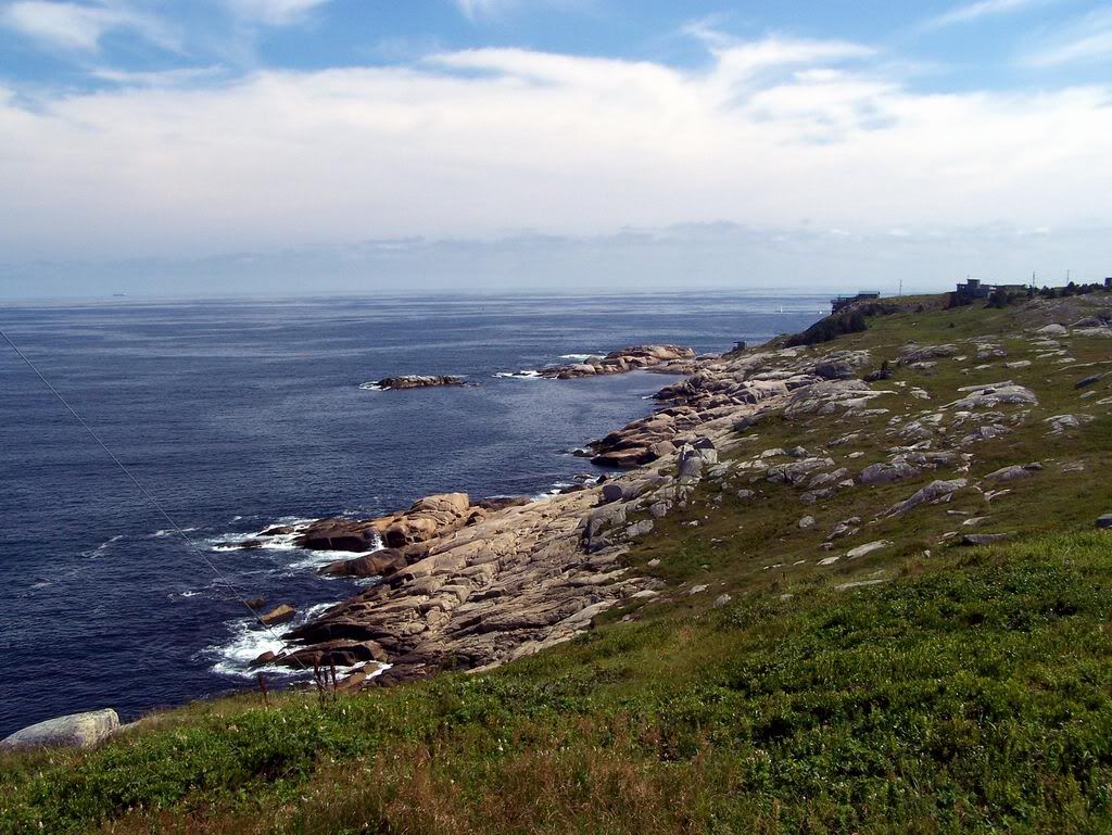
I was finally able to make it out to the ruins and reclaimed portions of Fort Chebucto found in Duncan's Cove outside of Halifax, NS. Fort Chebucto was operational during the Second World War from 1943 until 1945.
View Halifax Defence Complex in a larger map
1. Ruins of Fort Chebucto's light emplacements in the distance.

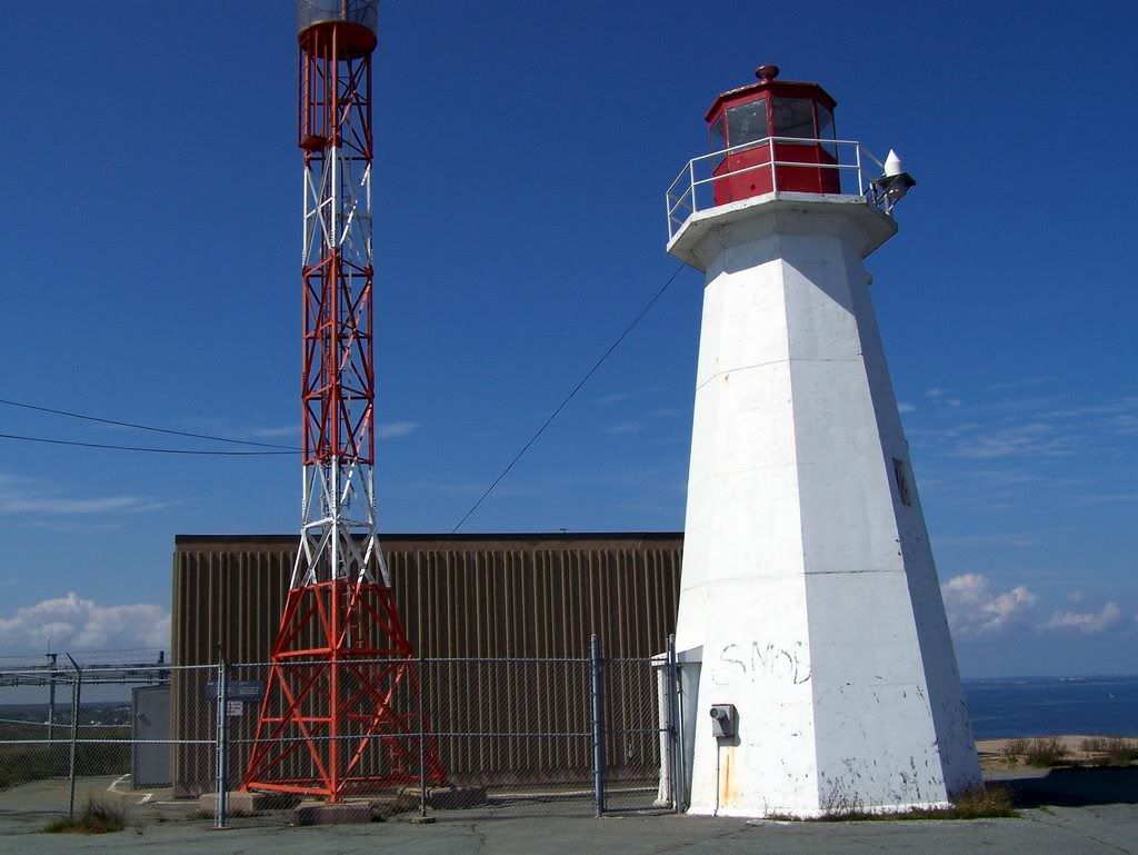
2. Active RDF Station at Chebucto Head.

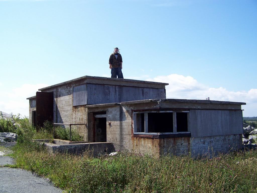
3. Tristan checking out the roof of the Depression Range Finder building at Chebucto Head.

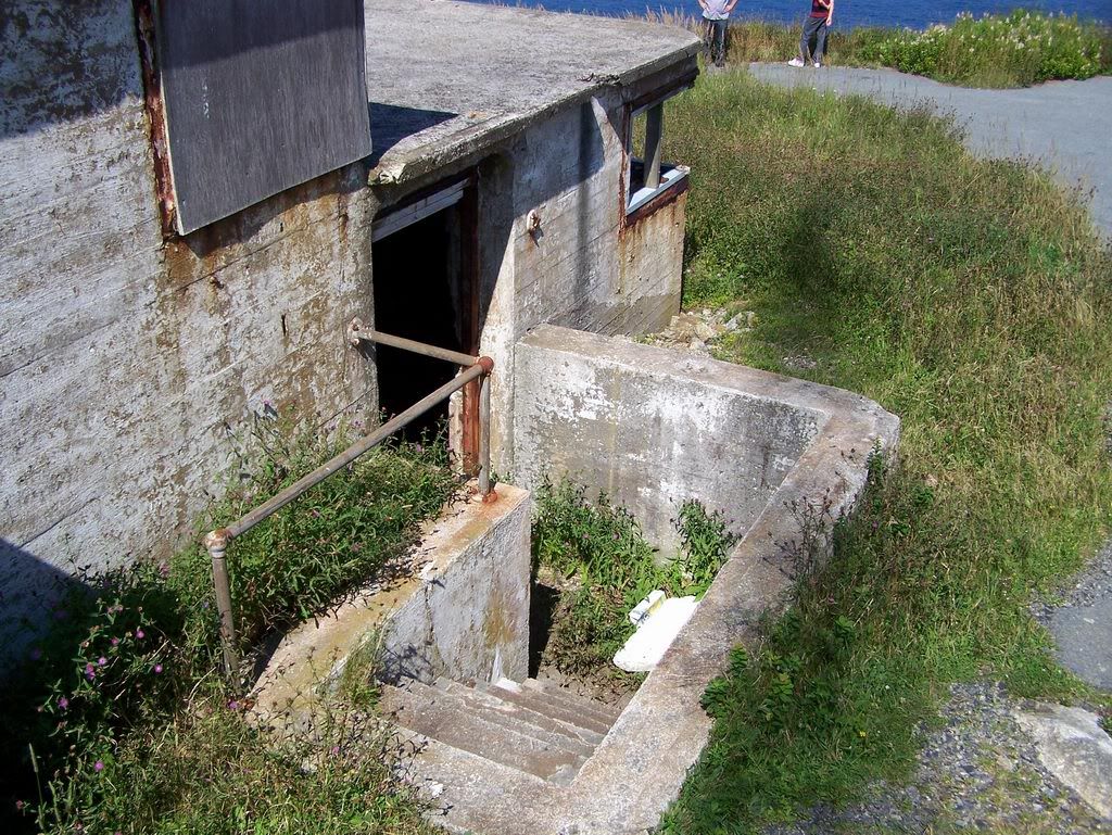
4. Entering the Depression Range Finder building.

5. Inside the Depression Range Finder building.

6. Group shot atop the Depression Range Finder building at Chebucto Head.

7. Light emplacement ruin below the reclaimed Base Command Post (BCP) of Fort Chebucto.

8. Light emplacement ruin below the reclaimed Base Command Post (BCP) of Fort Chebucto.

9. Rocky cliff below Fort Chebucto.

10. Light emplacement ruin below the reclaimed Base Command Post (BCP) of Fort Chebucto.

11. Looking back at the RDF Station from nearby to the light emplacement ruin.

View Halifax Defence Complex in a larger map
1. Ruins of Fort Chebucto's light emplacements in the distance.
2. Active RDF Station at Chebucto Head.
3. Tristan checking out the roof of the Depression Range Finder building at Chebucto Head.
4. Entering the Depression Range Finder building.
5. Inside the Depression Range Finder building.
6. Group shot atop the Depression Range Finder building at Chebucto Head.
7. Light emplacement ruin below the reclaimed Base Command Post (BCP) of Fort Chebucto.
8. Light emplacement ruin below the reclaimed Base Command Post (BCP) of Fort Chebucto.
9. Rocky cliff below Fort Chebucto.
10. Light emplacement ruin below the reclaimed Base Command Post (BCP) of Fort Chebucto.
11. Looking back at the RDF Station from nearby to the light emplacement ruin.
Subscribe to:
Comments (Atom)