26 January 2011

Georges Island & NS Power Lower Water Street Relocation

Just a quick update today with three photos from downtown Halifax.

This first is Georges Island. I've blogged about Georges several in the past and had the opportunity to visit the island drumlin in June 2008.

Some background on Georges Island...

The island was first fortified in 1750, shortly after Halifax was founded in 1749. During the Acadien Explusion from 1755 through 1763, those facing deportation were kept on the island, which doubled as a prison.

Defenses on the island were strengthened during the American Revolution, throughout the 1790s, and again during the War of 1812 and American Civil War. After 1850, with advances in technology, the fort was again overhauled, building the modern Fort Charlotte on the island.

Georges Island played a small role in Halifax's defense during both World Wars I and II, notably anchoring a submarine net protecting the inner harbour during World War 1 and housing an anti-aircraft unit throughout World War 2. Military service on the island ended with the war and it was declared a National Historic Site of Canada some twenty years later.

Unfortunately, Georges Island is not normally open to the public. Parks Canada continues to work to restore the island to allow public visitation in the future.

Source: Parks Canada - Georges Island National Historic Site of Canada


Nova Scotia Power's relocation to a former Lower Water Street generating station pushes on. The building's exterior appears mostly complete and the interior has some lighting. The power corporation plans to move into this location in the Spring of this year.

The utility boasts that the redeveloped building will reduce it's environmental footprint. The building's list of key features includes (among many others) LEED platinum certification, sea-water heating, rainwater irrigation, and the glass interior, or 'curtain-wall,' designed to maximize natural light.


17 January 2011

Public Service Commission Power Plant at Conquerall Mills


I've passed by the former Public Service Commission Power Plant in Conquerall Mills, Nova Scotia thousands of times in my life. For nearly twenty years, I drove by 'the power dam' daily. Over those twenty years, the only thing to change at the dam was the 'For Sale' sign. It has been privately owned for decades and was rumoured to be on and off the real estate market at various times throughout.

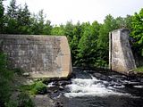
The former hydroelectric power plant is situated on the Petite Riviere, or Petite River, at Conquerall Mills. It was the only dam built on the Petite Riviere explicitly for power generation. Operations ceased in 1971. In 1974, the Town of Bridgewater abandoned the dam. The dam was breached in 1977.

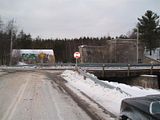
I visited and photographed the exterior of the power plant in January 2007 and again in June 2010. In that short span, only the boards covering the windows had changed. The area grows in considerably in the summer months.

Between visits to the power plant I was given a few historical photos of the dam. The photos were courtesy of my father who was scanning a collection of family photos. Among the scans were several newspaper clippings and two very grey photographs. The photographs show the power plant on the day it became operational some time around 1940.


1. Public Service Commission Power Plant on the day it became operational.
Photobucket

2. A second photo from the same day. To the left is my great-grandfather's 1939 Packard.
Photobucket

3. Newspaper clipping, October 18, 1961.
Photobucket

4. Photo from 1961 newspaper.
Photobucket

5. January 2007. To the right is my old 1989 Toyota.
Photobucket

7. June 2010.
Photobucket

8. June 2010.
Photobucket

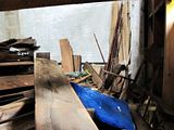
9. June 2010 - Lumber stored inside the power plant.
Photobucket

10. June 2010 - Looking up inside the power plant.
Photobucket

11 January 2011

Downtown Halifax Tunnels


For decades construction crews have been bumping into passageways beneath Halifax's downtown core. The tunnels under Halifax have been written about and discussed for decades. The official line was that they were not actually passageways, but sewers.

They're definitely not sewers.

Photographs taken in 1976 show rock walls with arched ceilings, approximately six feet high, and wooden floors.

Rumours suggest that many of the older buildings that did, and still do, stand downtown could access these tunnels from their basement level.

We know there are, or were prior to development, stone passageways under many streets in the core. What we can't seem to agree on, or confirm true, is the existence of other tunnels branching out from the downtown. Some believe a tunnel connects Brunswick Street to the Halifax Citadel. Others suggest a tunnel connects the Halifax Citadel to the Halifax Armoury at the corner of North Park and Cunard Street. Both make sense, but I have yet to encounter anyone who can confirm or deny they're actually there.

Then there is the tunnel that allegedly runs from somewhere near the harbour, presumably near Sackville at Lower Water Street, and then beneath the harbour floor, eventually surfacing on the once militarized George's Island.

The George's Island under-water passage has been debunked but some of the mystery still remains in the words of 19th century mason John William Cameron. Cameron, although sworn to secrecy, claimed to have built two tunnels under Halifax- the tunnel to the Citadel as well as the tunnel to the island.

Over time I've built a map to illustrate where the tunnels might potentially lie. To my knowledge, only a few of them are at all accessible.


View Downtown Halifax Tunnel System in a larger map.
Confirmed (Blue Marker) ― These are documented tunnel entrances, some verified by photo.
Date Entrance Location
2012 1682 Hollis St (Halifax Club)
1995 Sackville St at Lower Water St
1977 Duke St at Granville St
1976 Price St at Grafton St
1973 George St
1938 Duke St at Market St
1919 Town Clock

Rumoured (Yellow Marker) ― These tunnel entrances range from speculative to debunked.
Date Entrance Location
1995 Prince St at Market St
- 1740 Granviille St (Dennis Building)

Blue Lines ― Represent tunnels that almost certainly do, or did, exist.
Red Lines ― Represent tunnels that do not exist, or are not likely to exist.

08 January 2011

Rehabilitation Centre Video

Filmed in October 2009.

Follow the camera through the halls and wards of a former county rehabilitation centre abandoned in 2002.